
Items
Tag
map
-
 Sanborn Insurance Maps of Weehawken 1910 Very detailed maps of Weehawken in 1910 from the Sanborn Map Company. According to the Princeton University website hosting these maps, "The Sanborn Map Company is the oldest mapping company in the United States. Founded in 1866, the company created detailed building maps of cities and towns all across the country, primarily for use by insurance companies. These maps also have been used extensively by local government agencies for over a century in conducting their daily operations efficiently. Approximately 12,000 American cities and towns are chronicled in the company's collection of over one million maps. As a result of its history, the name Sanborn has become synonymous with this kind of map. Genealogists, local history buffs, city planners, architects, and countless others have been drawn to the quality of detail found in them. "
-
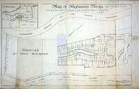 Map of Highwood Bluffs 1909 Map of Highwood Bluffs, the extension of High Bluff Terrace, printed in 1909. The area was purchased by S. E. Renner and Thomas Henry, developers of this area and also Sterling Avenue, on the other side of the Hudson Boulevard, now Boulevard East. Drawn over lots 27-30 is the outline of Highwood Bluff, or the Bluff, the home of Archibald Gracie King, son of James Gore King, who settled in Weehawken in 1832. Archibald died in 1897, but the home remained standing until the mid-1920s.
-
 Sanborn Insurance Maps of Weehawken 1900 Very detailed maps of Weehawken in 1900 from the Sanborn Map Company. According to the Princeton University website hosting these maps, "The Sanborn Map Company is the oldest mapping company in the United States. Founded in 1866, the company created detailed building maps of cities and towns all across the country, primarily for use by insurance companies. These maps also have been used extensively by local government agencies for over a century in conducting their daily operations efficiently. Approximately 12,000 American cities and towns are chronicled in the company's collection of over one million maps. As a result of its history, the name Sanborn has become synonymous with this kind of map. Genealogists, local history buffs, city planners, architects, and countless others have been drawn to the quality of detail found in them. "
-
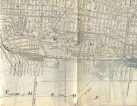 Map - Weehawken in 1926 This map of Weehawken from 1926 was part of a larger map of North Hudson included in The Red Book information guide. This item is in the collection of Willie Demontreux.
-
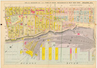 Weehawken Portion of 1909 Hudson County Map Map of Weehawken and environs from a 1909 set of maps of Hudson County. These images were provided by www.wardmaps.com, which offers framed and unframed reproductions of these and other antique maps as well as original maps.
-
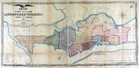 Map of Proposed Roads of Hudson Cty - 1868 This map is titled: Map Showing the Location of the Proposed Roads, County of Hudson, NJ as determined by the Commissioners It is dated 1868 and attributed to surveys made by D.E. Culver of Jersey City. This map resides in the collection of Rutgers University.
-
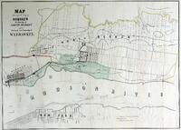 Map of the City of Hoboken, Township of North Bergen and the proposed new Township of Weehawken This map is entitled: Map of the City of Hoboken, Township of North Bergen and the proposed new Township of Weehawken. The map is undated, but it must be prior to 1859, since, this is the year Weehawken was incorporated as a Township. This map is part of the Rutgers University collection of historic New Jersey maps.
-
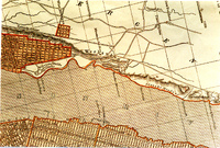 Weehawken Portion of 1842 Map This image shows the Weehawken portion of a map entitled New York and Vicinity and dated 1842. This map, published by Morse and Breeze, is in the collection of Tom Flagg, who provided this image.
-
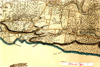 Weehawken Portion of 1841 Map This image shows the Weehawken portion of the Topographical Map of Jersey City, Hoboken and the Adjacent Country Describing Minutely the Courses of Rivers, Brooks, the Township and Original Patent Lines; Railways, Turnpike Carriage & Bridle Roads; the present farm boundaries with the names of their Proprietors, A correct plan of Public Grounds and Gentlemen's Country Seats, the position of Farm Houses, Forests, Swamps and Marshes, showing a complete view of the Face of the Country, from an actual survey by L.F. Douglass, Engineer, Jersey City, 1841. Copied from original in the Jersey Room of the Jersey City Public Library. This image was made and provided by Tom Flagg.
-
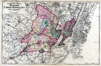 Map of Hudson, Union and Essex Counties - 1872 This map of the area around Weehawken was part of State Atlas of New Jersey Based on State Geological Survey and from Additional Surveys by and under the direction of F.W. Beers published by Beers, Comstock and Cline New York City 1872
-
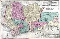 Map of Weehawken and Environs - 1872 This map of Weehawken and the surrounding towns was part of State Atlas of New Jersey, Based on State Geological Survey, and from Additional Surveys by and under the direction of F.W. Beers, published by Beers, Comstock and Cline, New York City, 1872.
-
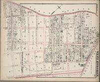 Map of Northern Part of West Hoboken - 1873 This map from 1873 shows the northern section of West Hoboken, which was adjacent to Weehawken. href="images/88106c.jpg">Click here for a larger image of this map
-
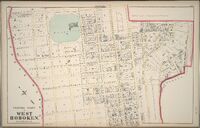 Map of Centre Part of West Hoboken - 1873 This map from 1873 shows the center part of West Hoboken, which bordered Weehawken. Map of Hudson County, New Jersey from Actual Surveys Under the Direction of GM Hopkins, CE No. 320 Walnut Street Philadelphia 2500 feet to the inch Engraved by Edward Busch, 1873
-
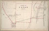 Map of Southern Part of Union Township - 1873 This map from 1873 shows the southern end of Union Township, which was just to the north of Weehawken. Map of Hudson County, New Jersey from Actual Surveys Under the Direction of GM Hopkins, CE No. 320 Walnut StreetPhiladeplhia2500 feet to the inchEngraved by Edward Busch1873 Images from the United States Library of Congress (G1258.H7H3)
-
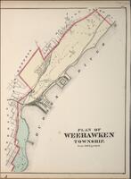 Plan of Weehawken - 1873 Map of the Town of Weehawken in 1873. Map of Hudson County, New Jersey from Actual Surveys Under the Direction of GM Hopkins, CE No. 320 Walnut Street Philadeplhia 2500 feet to the inch Engraved by Edward Busch 1873 Images from the United States Library of Congress (G1258.H7H3) 1745.42A Plan of Weehawken
-
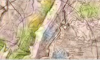 Map - 30 Mile Radius of NYC in 1842 Section of Map of the country thirty miles round the city of New York, drawn by I.H. Eddy and published by A. T. Goodrich, 1842 in New York. Weehawken is shown on this map, as is the King estate, and the monument to Alexander Hamilton. This map is from the collection of the New York Public Library (call number Map Div. 00-452
-
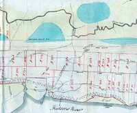 Hudson County Map - 1872 Portion of a map from a folio in the collection of the US Library of Congress entitled History of Land Titles in Hudson County, New Jersey 1609-1871, by Charles H. Winfield. This is a portion of the last of three maps in this folio. The map is undated, but given the title of the portfolio, it is probably circa 1871. There is no documentation of the meanings of the plot numbers. Interesting items on this map: Duelling ground, Weehawken Ferry Three Pigeons Inn and New Durham From the collection of United States Library of Congress Call # F142.H8W72, map # 3.
-
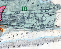 Hudson County Map - 1881 Section of a map contained in the Combined atlas of the State of New Jersey and the County of Hudson : from actual survey, official records & private plans / by and under the direction of G. M. Hopkins published by G. M. Hopkins & Co. of Philadelphia in 1873. Click on the 'view back of item' link below for a larger version of this image. From the map collection of the United States Library of Congress.
-
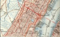 US Geological Survey Map - Weehawken - 1940 This is a scan of a portion of the 1950 reprint of a 1940 United States Geological Survey map of the Weehawken Quadrangle.
-
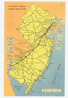 New Jersey Turnpike Map Colored postcard of a New Jersey with the Turnpike and major interchanges, undated.