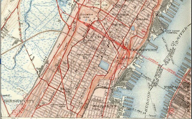
This is a scan of a portion of the 1950 reprint of a 1940 United States Geological Survey map of the Weehawken Quadrangle.
Subject
WHC302
Date
1940
Type
PD
Identifier
WHC302
Coverage
Weehawken, NJ [40.7663711,-74.02537149999999]
Tag
Maps
Rights
This digital image may be used for educational or scholarly purposes without restriction. Commercial and other uses of the item are prohibited without prior written permission from the Weehawken Historical Commission.