
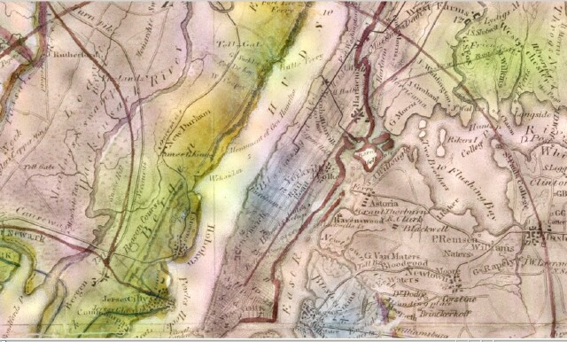
Map - 30 Mile Radius of NYC in 1842
Item

- Title
- Map - 30 Mile Radius of NYC in 1842
- Description
- Section of Map of the country thirty miles round the city of New York, drawn by I.H. Eddy and published by A. T. Goodrich, 1842 in New York. Weehawken is shown on this map, as is the King estate, and the monument to Alexander Hamilton. This map is from the collection of the New York Public Library (call number Map Div. 00-452
- Subject
- WHC88085
- Date
- 1842
- Type
- O2
- Identifier
- WHC88085
- Coverage
- Weehawken, NJ [40.7663711,-74.02537149999999]
- Tag
- Maps
- Miscellany
- Rights
- This digital image may be used for educational or scholarly purposes without restriction. Commercial and other uses of the item are prohibited without prior written permission from the Weehawken Historical Commission.
Tags
mapPosition: 1031 (122 views)